



It is not known when Gudhjem Harbour was established. Neither Hammers’ map from 1755 nor the Gudhjem cadastral map from 1861 shows a harbour. Both maps only indicate natural landing places, where “Ladhammer” and “Nordre Bryggeskæret” served as landing sites for fishing boats. Salchov’s military description of Bornholm from 1813–14 does not mention harbours in either Gudhjem or Melsted either.
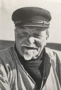 The Gudhjem fisherman Peter Koch (1860–1952) describes life in Gudhjem in the books “Det hvisker fra havet” and “En Gudhjemfisker fortæller”. According to him, the first breakwater consisted “of wooden boxes filled with stones, about 1½ metres above the surface”, as shown in his drawing below.
Today it is called Søndre Brygge or, colloquially, “bådahamn”. “Nordre Brygge was built later from larger split stones with a bolted-on horizontal batten.”
When Christian V established the fortress on Christiansø in 1684 in the wake of the Swedish Wars, the fishing villages of Gudhjem and Melsted were required to provide transport to and from Christiansø. These transports served military and general supply purposes, as well as transporting government officials. The fishing villages were also responsible for mail and the supply of money – in return, Gudhjem and Melsted received certain tax privileges.
It is therefore likely that these royal transports resulted in Nordre Brygge being established at an early stage with quay-like facilities to make loading and unloading easier.
In the 1787 census, three boatmen and six fishermen/labourers were among the local inhabitants and were officially responsible for the necessary transport, although the fishermen sometimes had to put their own work aside.
In the 1801 census, there were no people with these titles. This may be seen as an expression of the fortress’s declining military importance. However, the fortress experienced a brief revival during the English Wars of 1807–1814.
During the first half of the 19th century, Gudhjem managed with the old harbour with its wooden pier and the many natural skerry harbours in the area. To the northwest were “Holkara-hamn” and “Petersa-hamn” (Peter’s Harbour), while to the north were “Klausa-hamn” (Klause’s Harbour), “Ladhammer” at Blegeklipperne, “Sander Larsens hamn” and others at “Norresan” (Nørresand). During the winter, the boats were pulled up onto the gravel and sandy beach.
Harbour Expansions in the Late 19th and Early 20th Centuries
During the second half of the 19th century, the need for a larger harbour increased. The population doubled between 1801 and 1860 due to migration from Christiansø to Gudhjem. During the same period, the number of fishermen increased from 44 to 78, in line with the general development of the fishing industry, in which large quantities of herring were sold both locally and in Copenhagen, either fresh or smoked.
According to Peter Koch, Gudhjem’s new harbour was equipped with a slipway and a new quay wall towards the land in the summer of 1972, replacing the old gravel and sandy beach. At the same time, the harbour was deepened. But already in November, the harbour was destroyed by the storm surge and subsequently had to be repaired.
The need for a better harbour arose with the establishment of Det Østbornholmske Dampskibsselskab in 1876. The first East Bornholm steamship, “Erna”, docked at Nordre Brygge in 1877. Following the company’s great success, it was decided that the harbour should be deepened and expanded in a major construction project in 1883–85, bringing it close to its present size.
In 1935, the harbour was deepened again, while the outer harbour was enlarged to accommodate the now large East Bornholm steamers S/S Østbornholm and S/S Nordbornholm. Both during the expansion of 1883–85 and the deepening in 1935, the granite blasted from the rock formations at “Ladhammer” and “Holkara-hamn” was used as fill, increasing the harbour area for the fishermen’s work and later for the large car park.
As a result, the large natural skerry areas around the harbour were lost.
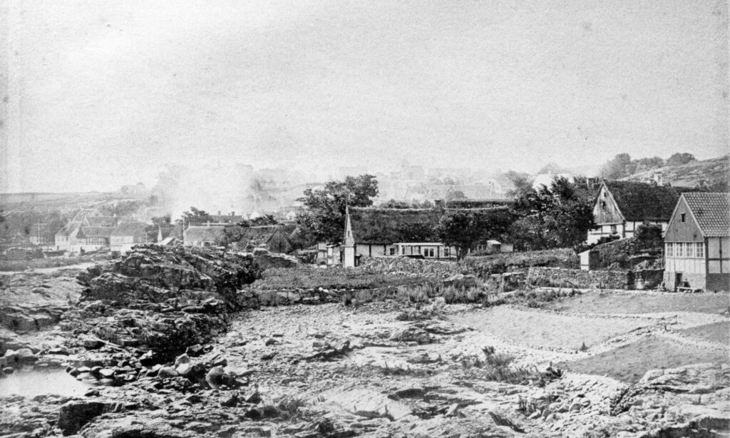
Photo: The area around Holkara Cliff was used as a net-drying ground, where fishing nets were spread out and dried. It was later levelled to create the large car park during the harbour works of 1935. On the right is Maans Pærs Huz, which is still there today.
You can find many more photographs from Gudhjem Harbour in the digital photo archive.